LiDAR Directory
Find manufacturers and suppliers of LiDAR hardware and software.
Hardware
Airborne Hydrography AB (AHAB)
Jonkoping, Sweden
Airborne Hydrography AB develops and markets airborne laser survey systems for hydrographic and topographic surveys. Their key products are the Hawk Eye II bathymetric survey system and the Dragon Eye pure topographic survey system.
www.airbornehydro.com

Laseroptronix
Taby, Sweden
Laseroptronix have been in the electro-optical area since 1977 and have a huge expertise in this area. With a small company network of about 15 people their main area of activity are in Laseroptronix developed and made products. They also import products into Sweden and many other countries.
www.laseroptronix.se
Leica Geosystems
Heerbrugg, St. Gallen, Switzerland
Leica Geosystems is best known for its broad array of products that capture accurately, model quickly, analyze easily, and visualize and present spatial information. Leica Geosystems is continuing to set new technological milestones all over the world.
www.leica-geosystems.com
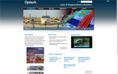
Optech
Toronto, Canada
Optech offers both standalone and fully integrated lidar and camera imaging solutions in airborne terrestrial mapping, airborne laser bathymetry and industrial process control, as well as space-qualified sensors for orbital operations and planetary exploration.
www.optech.ca
RIEGL
Horn, Austria
With 30 years experience in the research, development and production of laser scanners, rangefinders and distancemeters RIEGL delivers proven innovations in 3D. Dedicated to designing and developing the best possible laser sensors for the desired application.
www.riegl.com
Surestar
Beijing, China
Surestar focuses on developing and producing various laser scanners suitable for efficient imaging, measurement and surveying. Surestar also provide customised products and services to ensure that equipment and integrated systems work in demanding environments.
www.isurestar.com
Trimble
Sunnyvale, California, USA
Though best known for GPS technology, Trimble integrates a wide range of positioning technologies including GPS, laser, optical and inertial technologies with application software, wireless communications, and services to provide complete commercial solutions.
www.trimble.com
Software
Applied Imagery
Washington, D.C., USA
Applied Imagery's Quick Terrain Modeler is a premier 3D point cloud and terrain visualization software package. Quick Terrain Modeler is focused on DoD and civilian applications and continues to evolve based on customer feedback.
www.appliedimagery.com
Bentley
Exton, Pennsylvania, USA
Bentley is a global leader dedicated to providing architects, engineers, constructors, and owner-operators with comprehensive architecture and engineering software solutions for sustaining infrastructure. Founded in 1984, Bentley has nearly 3,000 colleagues in more than 45 countries.
www.bentley.com
Cardinal Systems LLC
Florida, USA
Cardinal Systems is the provider of the Vr Mapping software suite. Vr Mapping is the result of over 25 years of software development in the mapping industry with applications for aerial and close range photogrammetry.
www.cardinalsystems.net
Compass Data Inc.
Centennial, USA
For more than 20 years, CompassData has been a leader in the geospatial technology industry. We provide an array of products and services, including GPS survey equipment, GPS mapping tools, Trimble service and field data collection. Call 303-627-4058.
www.compassdatainc.com
GeoCue Corporation
Madison, Alabama, USA
GeoCue Corporation is a provider of products, training and consulting services for airborne and mobile LIDAR applications. They are the North American authorized distributor for Terrasolid OY, the purveyor of the world's most widely used LIDAR production tools.
geocue.com
Merrick & Company
Aurora, Colorado, USA
Merrick & Company is an employee-owned, multidisciplinary professional services firm specializing in the energy, security, life sciences, and infrastructure markets. The firm provides engineering, architecture, design-build, and geospatial technologies services.
www.merrick.com
QCoherent Software LLC
Colorado Springs, Colorado, USA
QCoherent Software LLC's extensive knowledge of geospatial software and LIDAR in particular focuses on the long-standing need for an Environmental Systems Research Institute (ESRI) ArcGIS extension for viewing and analyzing LIDAR data.
qcoherent.com
SAIC
Colorado Springs, Colorado, USA
Scientific Applications International Corporation is a scientific, engineering, and technology applications company that uses its knowledge to solve problems of vital importance to the nation and the world, in national security, energy and the environment, critical infrastructure, and health.
www.saic.com
Terrasolid
Helsinki, Finland
Terrasolid software packages are used world-wide for airborne and mobile Lidar data and image processing. Each package fills the requirements of their specific task, including data calibration, point classification, image processing and delivery production.
www.terrasolid.fi
Textron Systems
Providence, Rhode Island, USA
Textron Systems businesses are industry leading developers and integrators of unmanned systems, advanced marine craft, armored vehicles, intelligent battlefield and surveillance systems and geospatial management and analysis systems
www.vls-inc.com